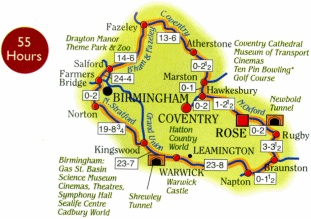
This canal holiday route can be achieved in 1 week but is better enjoyed as a longer break.
|
1 to 2 Week Route
|
105 Miles
|
120 Locks
|
55 Hours
|
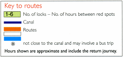
Click on the button below to see some photos of one of our 4/6 berth narrowboats “Concerto” taking 10 days over the Warwickshire Ring allowing time to visit places on the way. 
|
The Oxford Canal was engineered by James Brindley and built as a “contour canal” which means that the line follows the contours of land with a minimum of earthworks. This created a very tortuous route and the northern section of the canal was modernised in the 1830’s, almost halving the distance from Coventry to Braunston, striding across the countryside with a series of impressive arrow straight cuttings and embankments interspersed with winding sections of the original canal.
The first part of your journey is along mostly “new” canal (only about 180 years old!) and after passing through some impressive cuttings and high above open farmland you reach Ansty in about 1 ½ hours. The embankment just before Ansty was the site of a serious breach in November 1963 when a 30ft high embankment gave way and washed 10,000 tons of clay and sand onto adjoining land. Fortunately the problem was spotted by a farmer who, out for an early morning walk with his dog, noticed one of his fields was now under water. He raised the alarm and quick action by British Waterways staff prevented the breach becoming a serious catastrophe that could have closed the Oxford Canal for a long time. Repairs were completed quickly and the canal re-opened for traffic. The site of the repair is still visible (look for the concrete section of wall) and the location today makes a good place to tie up and visit the pay-and-play golf course (with an excellent club house) you reach Ansty in about one hour. Here there is a pottery and the Rose and Castle has an excellent reputation for food. 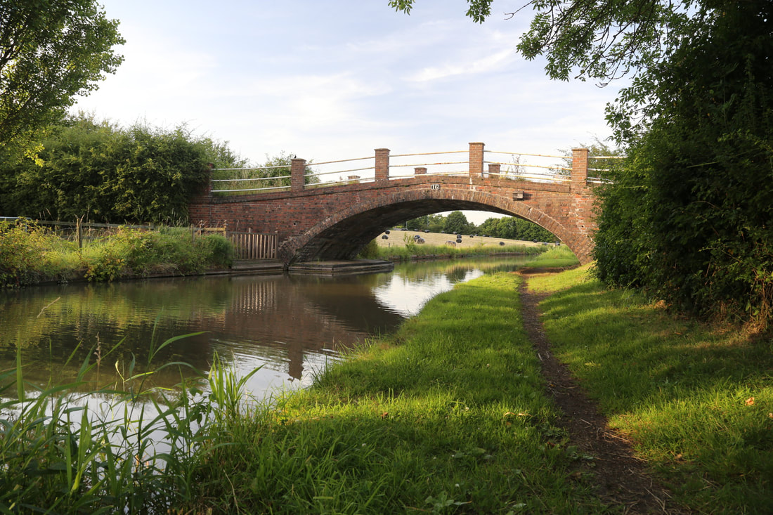
After Ansty you approach the outskirts of Coventry, but the canal still manages to retain a rural character for much of the one and a half hour run into Hawkesbury Junction (also known as Sutton Stop). Hawkesbury Junction was designated a conservation area in 1976 and is something of an industrial archaeology haven despite much development around it. 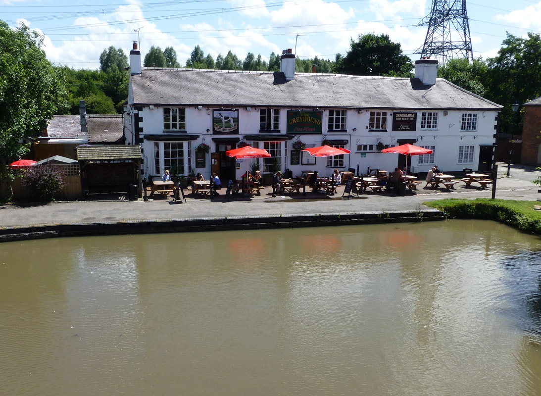
There is an impressive cast iron bridge, an engine house that once housed a Newcomen Beam Engine, a colourful pub (the Greyhound), and a 6 inch deep stop lock. Just down the road is another pub, the Boat. This area is rich in industrial history; you can discover the mysteries of the Newdigate Arm, Arbury Hall and the various quarries and coal mines that were the raison d’etre of the canal in the first place. Go right round the junction (a 180 degree right turn to test the helmsman’s skill) and continue north along the Coventry Canal; the left turn takes you on a very urban journey into the basin in Coventry centre. Heading towards Marston Junction, you pass through a long wooded cutting before skirting Bedworth and passing the historic Charity Dock. Soon you come to Marston Junction where the Ashby Canal branches off to your right. This is about one hour from Hawkesbury and about three and a half hours from the boatyard. 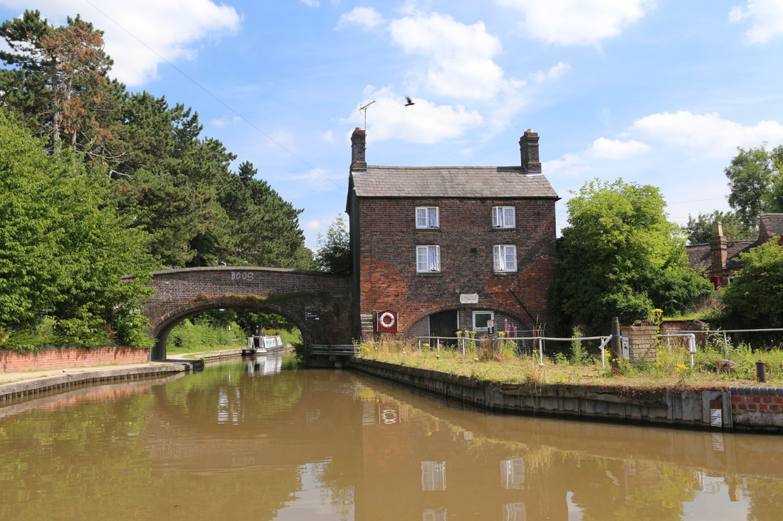
This area is rich in minerals and if you look carefully you can see many old wharves which provided much of the traffic for the Coventry Canal in its commercial heyday. Nowadays the land has been restored – but keep an eye out for “Judd’s Mount”, a former spoil tip that is something of a local landmark. The Anchor Inn at Hartshill has an extensive children’s play area and good food. The nearby maintenance yard has been attractively restored and the trip from here to Atherstone is very pleasant. At Atherstone the canal descends a pleasant flight of 11 locks. The top five are quite close together, the bottom half of the flight is more spread out as the canal heads out into the countryside in the direction of Tamworth, which is about 7 miles away. The next place of note is the village of Polesworth which has good moorings, and just beyond is Pooley Hall and an old colliery loading basin. The collier is long gone now and the adjacent land, formerly a spoil tip, is now pleasant nature reserve. Just before you reach Alvecote, where there is a marina and popular pub, there are moorings on the left hand side for the site of Alvecote Priory. 
The canal now enters the outskirts of Tamworth, dropping through two locks at Glascote before crossing the River Tame on a substantial brick aqueduct to reach Fazeley Junction. Here the Coventry Canal carries straight on but you turn left onto Birmingham & Fazeley towards Birmingham. The canal now passes Drayton Manor Park and Kingsbury Water Park before it reaches Curdworth. The bottom lock here marks the start of a long climb into Birmingham. Two locks up is the village of Bodymoor Heath – a good place to stop for the night. 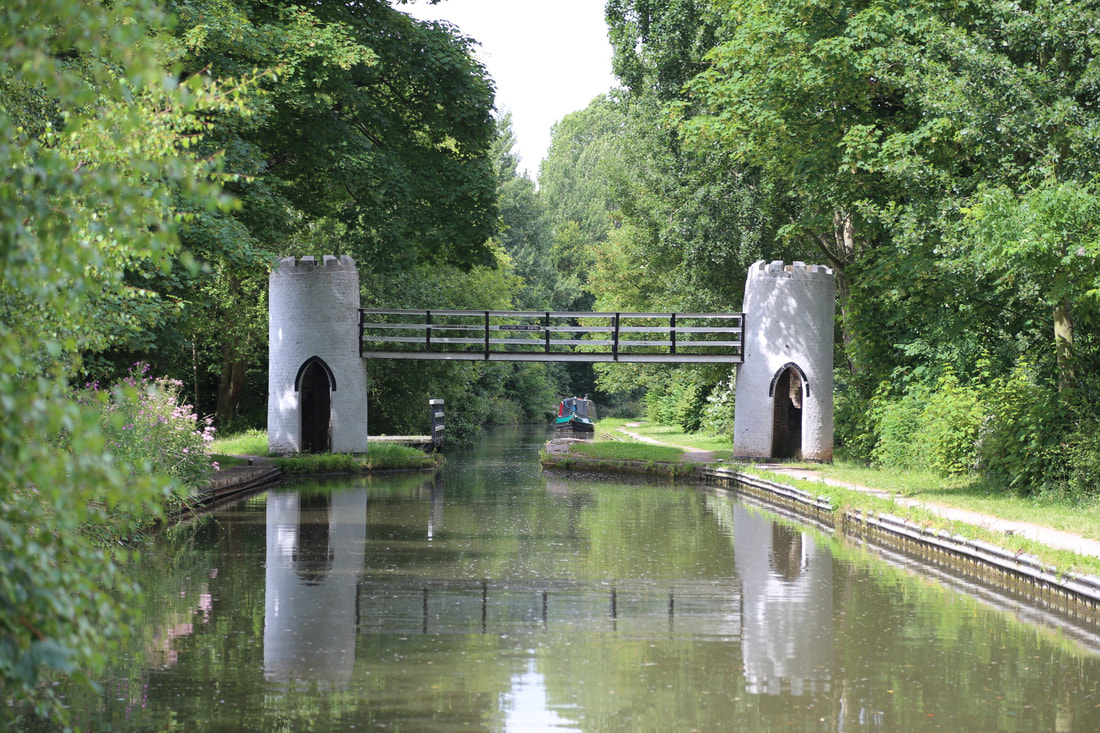
The next day will be memorable for the number of lock-flights. Curdworth, Minworth, Aston and Farmer’s Bridge all have to be tackled before you reach your destination – Gas St Basin. In the heart of Birmingham there are good moorings here and easy access to shopping, the Sea Life Centre, the National Indoor Arena, theatres and public transport links. 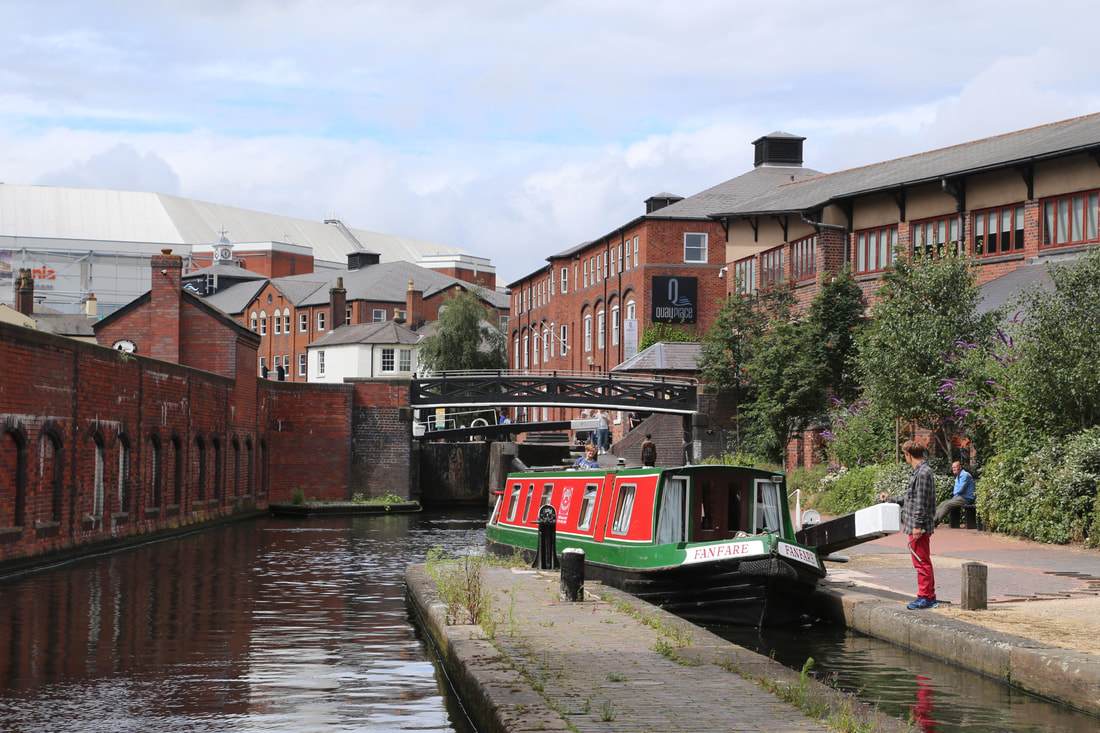
When the Birmingham & Worcester Canal was built in 1795, its directors could not reach agreement with the Brimingham Canal so there was not a physical connection between the two. The narrow strip of land separating them was called the Worcester Bar, across which all cargoes had to be shipped. After 20 years common sense prevailed and the stop lock was built to allow boats to finally pass between the two canals – and today means you can continue your journey. 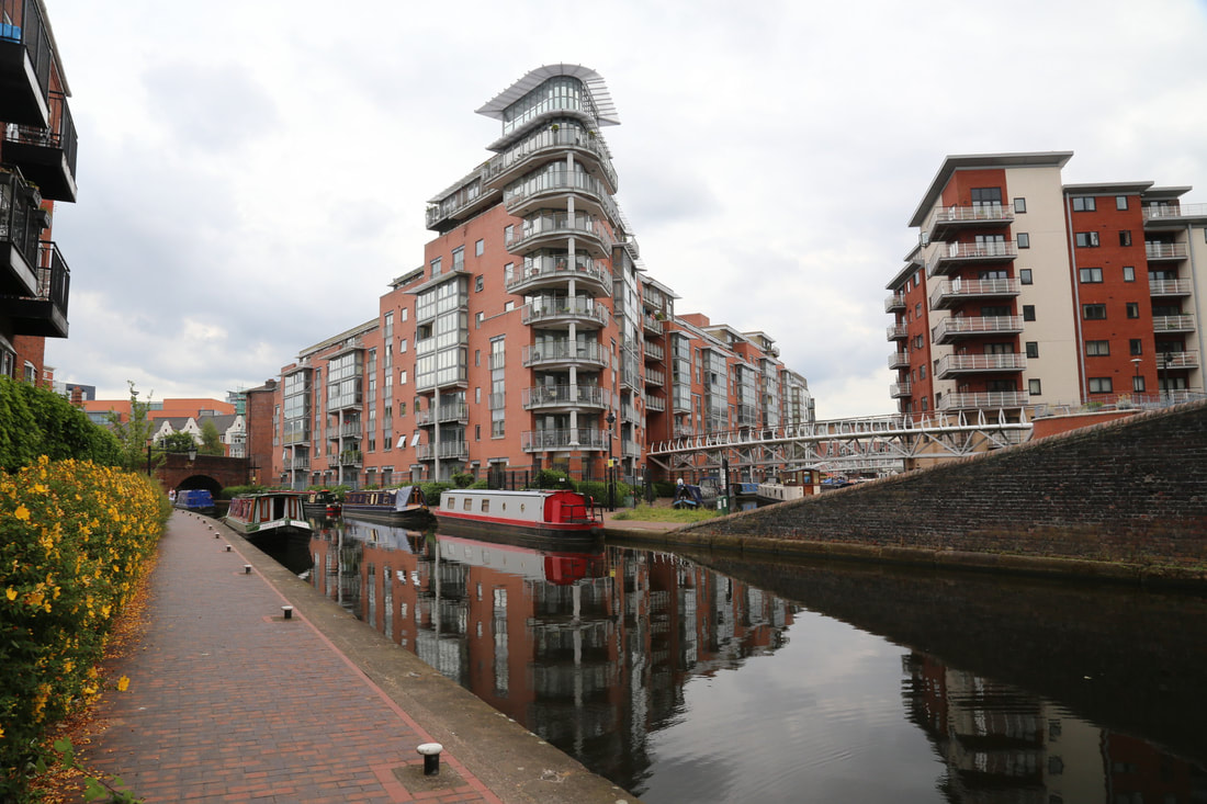
The Worcester & Birmingham canal runs on the level out of Birmingham past the famous Cadbury’s factory at Bourneville, which for many years used to receive and despatch goods by water. At King Norton Junction you turn left and through an unusual stop lock with guillotine gates onto the Stratford Canal. 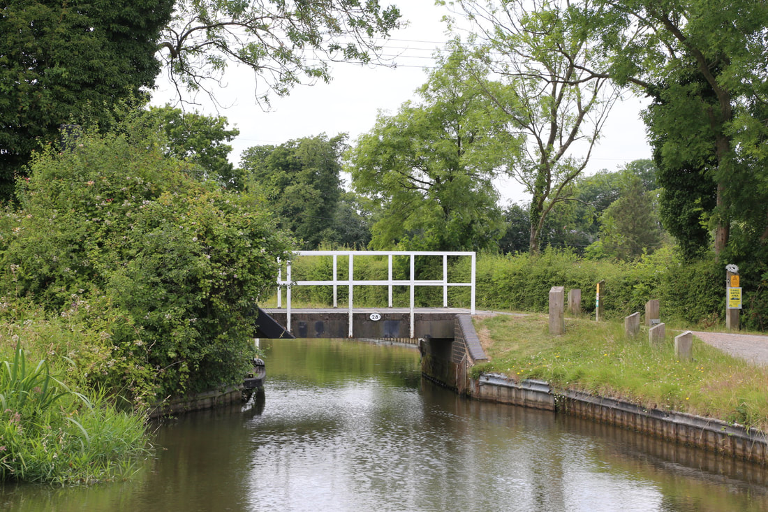
The Stratford canal runs level for nearly 12 miles now, passing Hockley Heath (a popular mooring spot) before reaching the top of Lapworth Locks where 19 narrow locks will lower you to Kingswood Junction where you turn on to the Grand Union Canal. 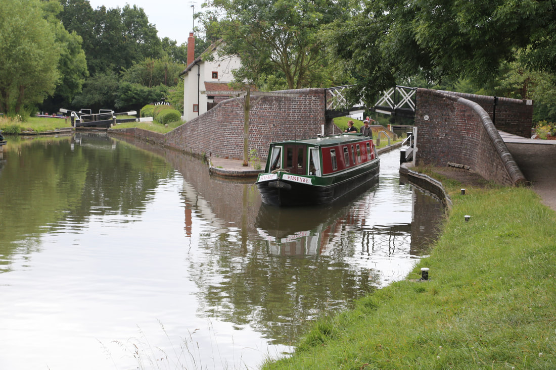
The next length, originally built as a narrow canal by the Warwick & Birmingham Canal Company was absorbed into a new company, the Grand Union Canal Company in 1929. It runs on the level for the next four miles past several pretty villages, but there is some impressive engineering used to accomplish this with an unusual tunnel at Shrewley (with a separate tunnel for the towing path) and some large embankments, especially near the village of Rowington. At Hatton, a flight of wide 21 locks lowers you almost to the bottom of the Avon valley. There is a cafe, pub and Hatton Country World all close to the top lock, and just below the bottom of the flight is the Saltisford Arm – the original terminus for the Warwick & Birmingham Canal which has now been restored. It is run by the Saltisford Arm Trust and has good overnight moorings from which is the best place to visit the historic city of Warwick. 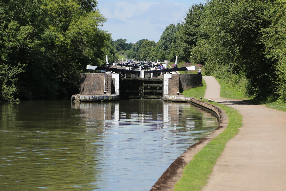
The Saltisford Arm entrance also marks the junction with the Warwick & Napton Canal. This was also a narrow canal which became part of the Grand Union, and like the locks at Hatton, all it’s locks were widened to accommodate two boats side by side as part of modernisation program in the 1930s to speed up the journey time for cargoes from London’s docks to Birmingham. The two locks at Cape finish your descent into the valley of the Warwickshire Avon, and the canal runs level again for about 4 miles before starting the gradual climb back up the other side at Radford Semele. Leamington Spa is an attractive town but it somewhat has its back to the canal. The aqueducts over the River Avon and the Birmingham-Oxford railway. Three locks up you pass under the Fosse Way, a road route originally laid out in Roman times, and shortly after you pass under another bridge carrying an even older road – Welsh Road. This was an important drover’s road, used by farmers from north Wales to move livestock from North Wales to the market towns of the south Midlands and London. 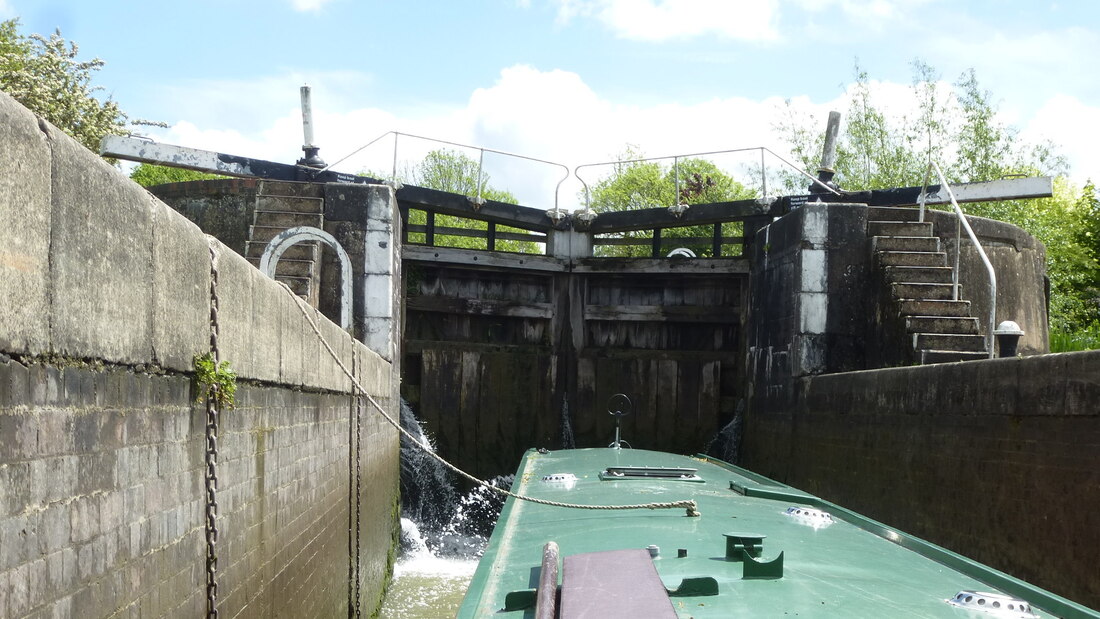
At Bascote there is a short flight of locks, the top two are a staircase and then another level run to Stockton, a thriving village with a good selection of canalside pubs. There are another seven locks here, again still with their redundant narrow locks alongside. Part way up the flight there is a short private canal (known as the Kayes Arm) which used to connect to a large cement works. Cement was carried from here to Birmingham by boat up until 1973 – one of the last regular commercial cargoes carried by narrowboats. The countryside opens out now, but although you are still over a day away from our boatyard by boat, it is less than 10 miles as the crow flies. Passing through 3 more wide locks at Calcutt you reach the end of the Warwick & Napton Canal at Napton Junction, known as Wigram’s Turn to the boatmen after the name of a local farmer now long gone where you turn left onto the Oxford Canal. 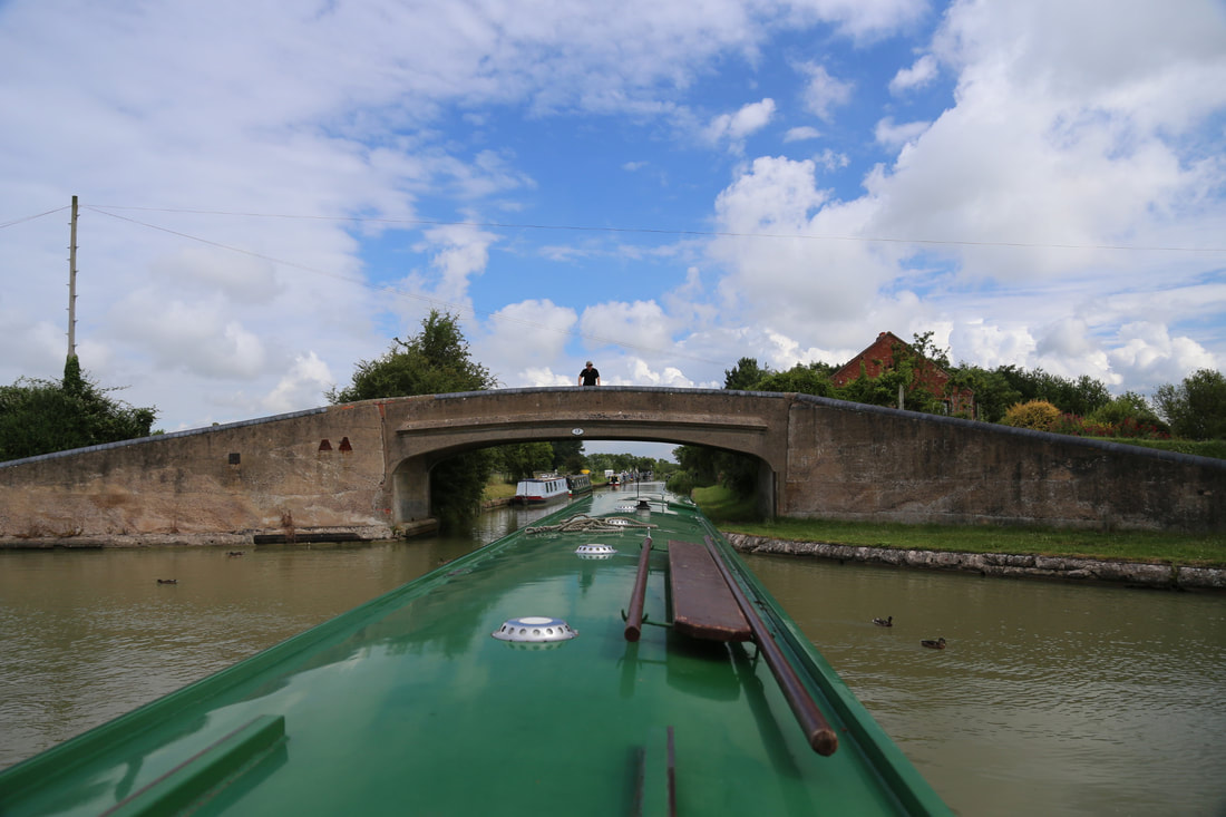
The Oxford winds it way through good farmland over the next five and a half miles passing the villages of Shuckburgh, Flecknoe and the abandoned village of Wolfhamcote with it’s lonely church before striding across the Leam Valley on a large embankment. It’s a measure of how important to the transport infrastructure of this country canals were that this embankment was bombed in a German air raid during November 1940. You can still see some hollows which are old bomb craters and one bomb did hit the embankment just by the aqueduct over the River Leam, causing significant damage and draining the canal. Amazingly, it was re-open to traffic again in a few days. 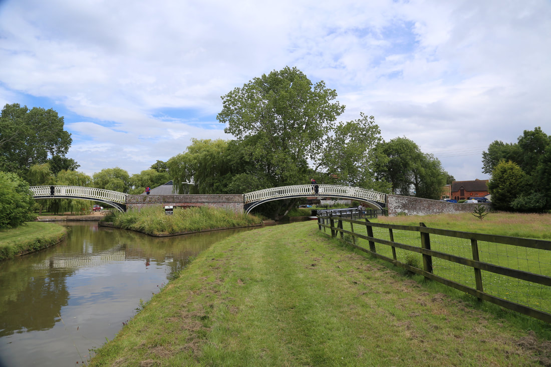
The puddle bank brings you to the village of Braunston, historically an important location on the canal network and no less so today. You turn left here (the right turn at the large junction takes you onto the southern part of Grand Union Canal towards London, but it is worth mooring up here and exploring the village and canal if you have time. After all the locks you have done on previous days it may come as a surprise that the last section of the route is so level. The Oxford Canal alternates between long straight sections built in the late 1820’s when Brindley’s original route was shortened by over 13 miles, and the more sinuous original lengths. 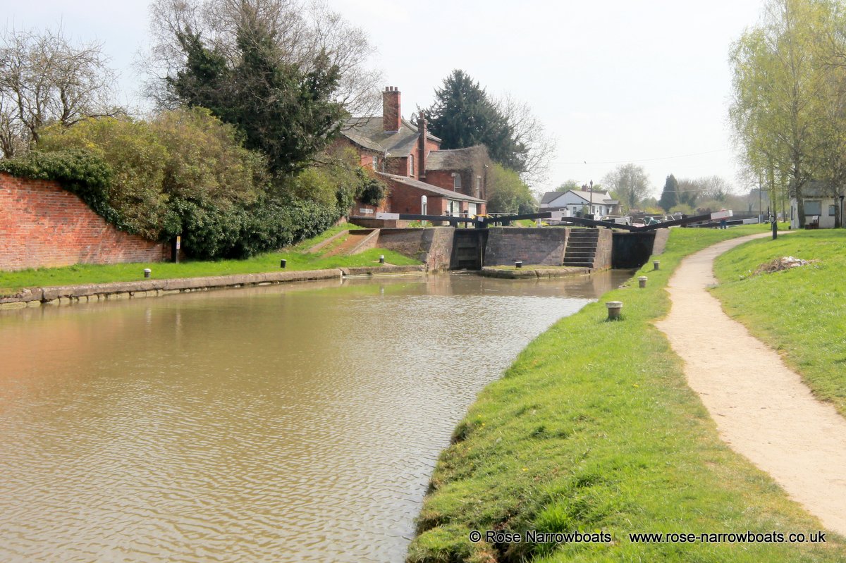
At Hillmorton you encounter your last flight of locks. The straightening of the canal had been such a success that the locks here were duplicated in 1840. Over 20000 boats passed through these locks in 1842. The canal company’s maintenance yard was situated just above the bottom lock, and the beautiful buildings, including the engineer’s house are still all there. Between Hillmorton and Stretton there are many short “arms” of the canal – short seemingly purposeless lengths of water which are actually some of the remains of the original route of the canal. They were retained to serve industry – normally flour mills or lime kilns – which had been built alongside the old line or because they carried out some other function such as water supply. Where necessary these are crossed by graceful cast iron bridges. These bridges are all identical and some of the earliest examples of mass production in the world. The canal passes through the outskirts of Rugby, but maintains some privacy in a series of leafy cuttings or embankments. There are good moorings close to Bridge 58 convenient for the adjacent retail park with a multiscreen cinema, restaurants and a 24hr Tesco supermarket. The moorings here or at Newbold are the best places to stop if you wish to visit the centre of Rugby. 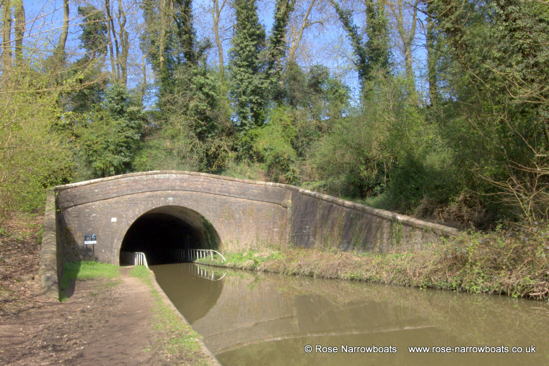
Newbold is a good stopping point on your last evening. Just before Newbold tunnel there is a pub The Barley Mow. It’s worth knowing as you walk along the access road in front of the pubs that this was once the canal. If you walk through the churchyard opposite on the public footpath you can find the original Newbold tunnel, now abandoned. From Newbold it takes just under two hours to return to our boatyard at Stretton Stop. |