1. The Wharf
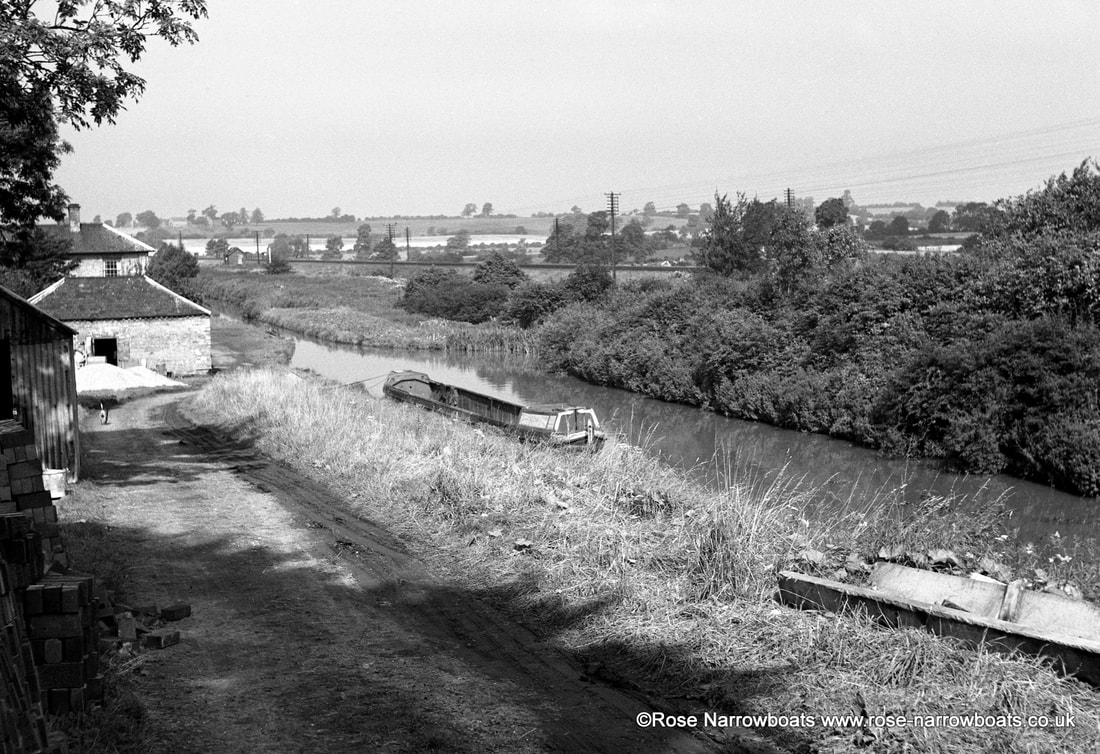
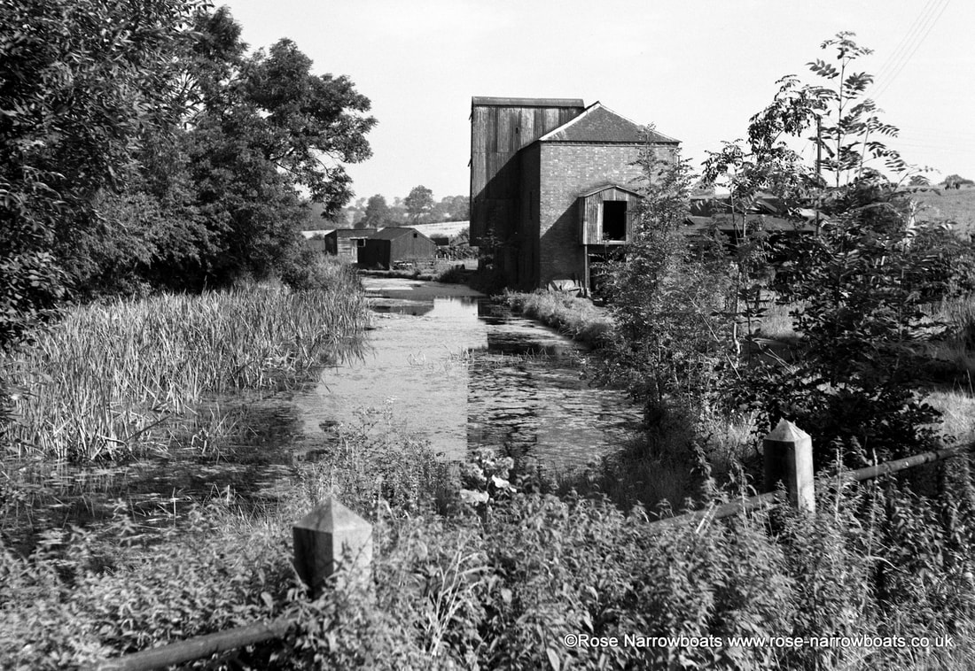
When the canal was originally built in the 1770s there were a number of wharves in the village of Brinklow itself, and another near Stretton. The straightened route bypassed these villages entirely but sections of the old canal were left in water to serve the wharves. The one at Stretton (opposite our site) leading to a major flour mill is still in water and used for moorings and the old flour mill is now Brinklow Boat Services’ boatyard. The arm to Brinklow still exists, but was out of use by the 1930’s and is no longer in water. The entrance can still be seen under the elegant cast iron bridge about half a mile south of Stretton Stop. In addition to these two wharves the Oxford Canal Company saw fit to provide another wharf (where our boats are moored today) for the transhipment of coal and agricultural goods. Coal was a very valuable commodity and there is a cellar under the toll house which was used as a secure coal store.
2. The Stable Block
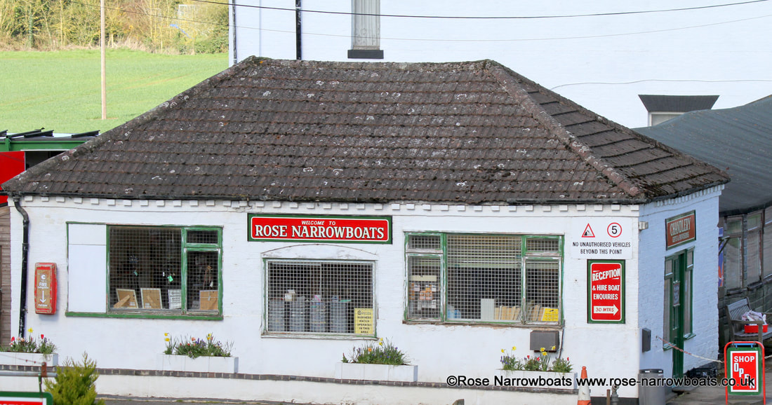
Until the 1930s the majority of narrowboats were horse drawn and canal companies provided stabling at certain points along their routes. The brick part of the what is now the shop/chandlery was one such building built in the 1830’s when major improvements were made to the Oxford Canal. If you look carefully at the front of the building (ie from the drive) you can still see where the doors used to be.
The original line of the canal ran at almost 90 degrees to what is now the main route, straight under where the stable block now is and then along the hedge adjacent to the shop, curving round and passing under the road to Brinklow a few hundred yards downhill from the current bridge. There is still a dip in the road today marking where that bridge was!
The original line of the canal ran at almost 90 degrees to what is now the main route, straight under where the stable block now is and then along the hedge adjacent to the shop, curving round and passing under the road to Brinklow a few hundred yards downhill from the current bridge. There is still a dip in the road today marking where that bridge was!
3 & 4. The Toll House and Stop
When the Oxford Canal was straightened in the 1830s the new route incorporated a long, tall embankment just north of here. The narrows next to the toll house (known as Stretton Stop) served two purposes – it contained a stop gate to retain water in the canal to the south if the embankment should fail and provided a convenient place for “gauging” boats.
Carrying boats paid tolls for using the canal based on the tonnage of goods it was carrying and the distance travelled. All boats used on the canal had to be registered and “gauged” by the canal company. This process involved gradually loading the boat with known weights and measuring the freeboard (the amount of boat hull side still above the water) as each weight is added. Each toll office kept a gauging book with details of every boat registered to use the canal, so by measuring the freeboard of the boat and comparing it to the gauging book, the amount of cargo carried could be determined and the toll calculated.
Tolls were the canal company’s main source of revenue, and in the 15 miles between the start of the Oxford Canal at Longford, Coventry and the junction with the Grand Junction Canal at Braunston there were toll houses at Hawkesbury, Stretton Stop, Hillmorton and Braunston.
The Toll Clerk at Stretton Stop also had responsibility for cargoes loaded and unloaded at the wharf, and the toll house has a large, brick vaulted cellar which was used for the secure storage of goods, mainly coal.
As the number of short haul traffics declined dramatically after World War 2 fewer toll houses were needed and the last tolls were collected at Stretton Stop in the 1950s after which the site became derelict for a few years.
5. Slipway
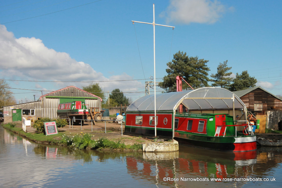
The slipway was built in 1962 when Maid Line set up the first hire fleet to operate from here.
The trolley is pushed into the water, a boat floated onto it, and then the tractor draws the trolley and boat gently back up the slope so the boat can be worked on out of the water, or pulled into the paint shed to be repainted.
The tractor dates from 1969, is one of only three of its kind built by County Tractors Ltd and can pull out a boat of up to 25tons.
6. Paintshed
The building was erected in 1964 to enable the painting of boats under cover. Boats are drawn up the slipway on a trolley by the tractor, which goes right through the building via a set of doors in the other end. The boat stays on the trolley in the shed and it takes about 6 weeks to fully repaint a narrowboat.
7. Stretton Arm
When the canal was straightened, the Stretton Arm was retained to serve a flour mill at Stretton Wharf. Like the Brinklow Arm it appears to have fallen into disuse by World War 2, but it still received basic maintenance because at the end of it there is a large weir to allow excess water from the canal to flow into the Smite Brook.
Control of water is of vital importance on a canal – not enough of it and the boats can’t move, too much and the canal overflows, potentially damaging the banks and causing damage to neighbouring property.
To prevent flooding, each section of canal had a lengthsman, responsible for inspecting and carrying out basic maintenance as well as controlling the water level by adjusting the flow over the weir. Nowadays each length has an electronic sensor connected via the internet to a computer to monitor the levels – but someone still has to go out to adjust the flow at the weirs and check that they are clear of obstructions.
8. The Old Line of the Canal
The canal originally ran straight under the old stable building and followed the line of the curving hedge round to the left before going under the Fosse Way about 200 yards further down the hill than it does today.
You can still see the dip in the road where the old bridge, demolished in the 1830’s, used to be. One of the capping stones from the old bridge was reused in the boundary wall of the toll house.
The cost of straightening the canal was estimated at £131,000 in 1829 and had actually cost just over £171,000 by completion in 1834 . The company soon set about selling off the unused sections of the old line such as this one which totalled nearly 10 miles in all and by 1843 had recouped over £7000 in sales of land and reclaimed materials.
Many of these sections are still visible today if you know where to look, and some of them are even still in water despite not having had a boat pass along them since 4th May 1834.
9. Brinklow Arches
The major civil engineering feature of Brindley’s original route between Hawkesbury and Hillmorton was the aqueduct which carried the canal across a shallow valley and the Smite Brook.
The aqueduct was approached by two long embankments of over 400 feet each and it cost £12000 to build at 1771 prices! It crossed the valley on 12 brick arches each of a 22′ span. When the canal was modernised in the 1830’s the canal was widened across here and the aqueduct largely buried by spoil removed from Brinklow cutting but one arch remains, shared by a footpath and the Smite Brook.
Originally, two arches were kept as passages, one arch was to be constructed as a dwelling for the lengthsman, another a stable, one as a hay and feed store, one as a forge and the remainder were to be used as dwellings, but there is no evidence that they were ever converted.
10. Smeaton Lane Aqueduct
The long brick arch here was built in 1830 to carry the new line of the canal over Smeaton Lane.
By the early 1840s up to 20,000 trips per year were being made along this section of canal by the various carrying companies. As boats seldom travelled after dark that equates to one boat every 12 minutes 7 days a week all year round.
In contrast with many earlier structures it was built such that the canal remains full width so as not to impede the flow of traffic.
11. Embankment
To achieve its more direct route the Oxford Canal’s new cuts took a straight line from point to point which often necessitated major earthworks, either in the form of deep cuttings or high embankments such as the one just past the water point from Rose Narrowboats.
If you look down into the fields from the embankment you can see how high you are above the surrounding ground. All the spoil to make this embankment was dug by hand out of Brinklow cutting and deposited here using no more than primitive wooden wheelbarrows!
The banks of the new sections of canal were lined with large stone blocks to protect against erosion. This was no doubt very expensive at the time but has proved to be a good investment as they are still in place today.
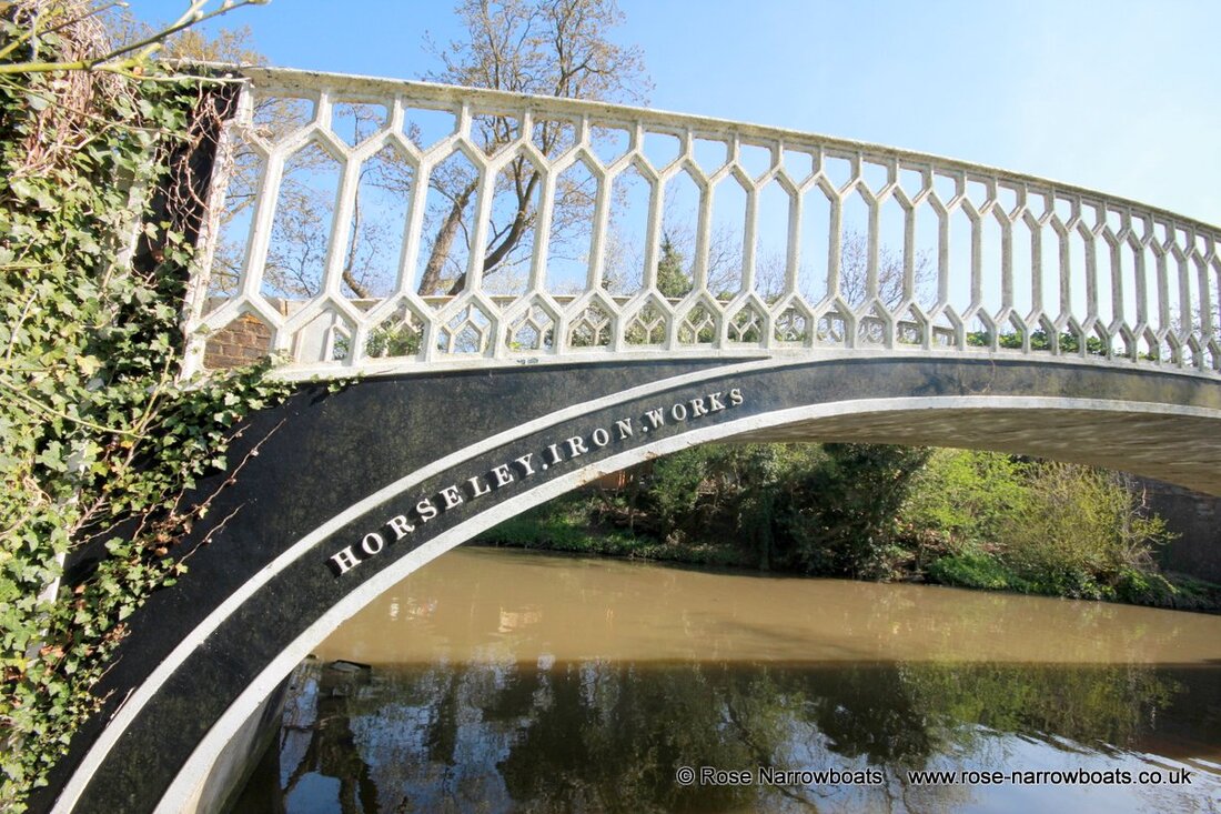
12. Horsley Iron Works Bridge
When the Oxford Canal Company straightened its route from Hawkesbury to Braunston it retained a number of sections of the old line to serve important wharves such as here at Brinklow.
Where the towing path needed to cross the parts of the old route the chief engineer of the straightening project, Charles Vignoles, designed these elegant cast iron bridges in 1830. A total of eight were built by the Horseley Iron Works and are believed to be the earliest examples of mass production in the world. All 8 survive and are in use to this day.
The grooves in the handrails were worn by the tow lines of the horse drawn boats as the horse walked over the bridge.
The arm here ran for about 500 metres to a wharf next to Lutterworth Rd in Brinklow, close to Ell Lane. Before the old line was closed, the road would have crossed the canal there, and the walls round the wharf appear to have been built using bricks from the demolished bridge.

